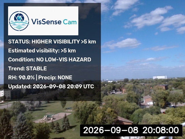
Higher visibility
No meaningful low-visibility signal is supported in the current scene, so the framework reports a broader higher-visibility category without assigning a low-visibility cause.
 VisSense Cam
Research Prototype · 2026
VisSense Cam
Research Prototype · 2026
VisSense Cam combines a fixed outdoor camera, camera-specific optical calibration, recent images from that same camera, and weather context representative of the deployment site. The framework is designed to identify reduced visibility and provide a concise interpretation of the current scene.
The framework first determines whether the camera scene supports a reduced-visibility condition. Fog or precipitation is interpreted only after low visibility is detected.
The camera and atmospheric context support a low-visibility condition. The next step is to interpret the most likely cause.
The scene does not show a meaningful low-visibility signal. VisSense Cam reports a broader higher-visibility category without assigning a fog or precipitation low-visibility condition.
VisSense Cam does not assume that one weather source represents every camera. Weather data are selected for each deployment site, with localized observations prioritized whenever they are available.
When a camera has a nearby or collocated weather source, VisSense Cam uses those observations for the variables available at that site.
If a localized source is missing a required variable, the framework can use the nearest available reporting METAR for that missing weather context when camera coordinates are configured.
For a new camera without localized weather observations, the deployment coordinates can be used to select the nearest reporting METAR as the atmospheric-context fallback.
The sources can be mixed by variable. For example, humidity and reference visibility may come from local instruments while precipitation context comes from the nearest available METAR.
Visibility reported by a weather station or METAR can be retained for comparison and validation. It is not used as the VisSense Cam predicted visibility and is not allowed to directly choose the customer-facing visibility result.
Cameras are not assumed to be optically interchangeable. Each deployment requires a camera-specific clear-scene reference and an independent commissioning check before equivalent performance should be assumed.
Keep the viewing direction, scene geometry, and zoom stable after commissioning.
Use representative clear scenes to characterize the normal optical structure of that camera and location.
Establish the camera-specific optical reference used to evaluate degradation in the current scene.
Compare the new deployment against independent visibility information before claiming performance equivalent to an already evaluated camera.
Recent optical trend and change-point information must compare images from the same camera. Frames from another camera are not mixed into the temporal comparison.
Optics, image resolution, orientation, distant landmarks, contrast, brightness, and clear-scene structure differ across deployment sites. Calibration reduces the risk of treating normal camera-to-camera differences as atmospheric visibility changes.
The annotated image communicates the current visibility interpretation while detailed routing, weather-source, and validation information can remain in diagnostics.
These examples illustrate the operator-facing annotated-image format.
No meaningful low-visibility signal is supported in the current scene, so the framework reports a broader higher-visibility category without assigning a low-visibility cause.
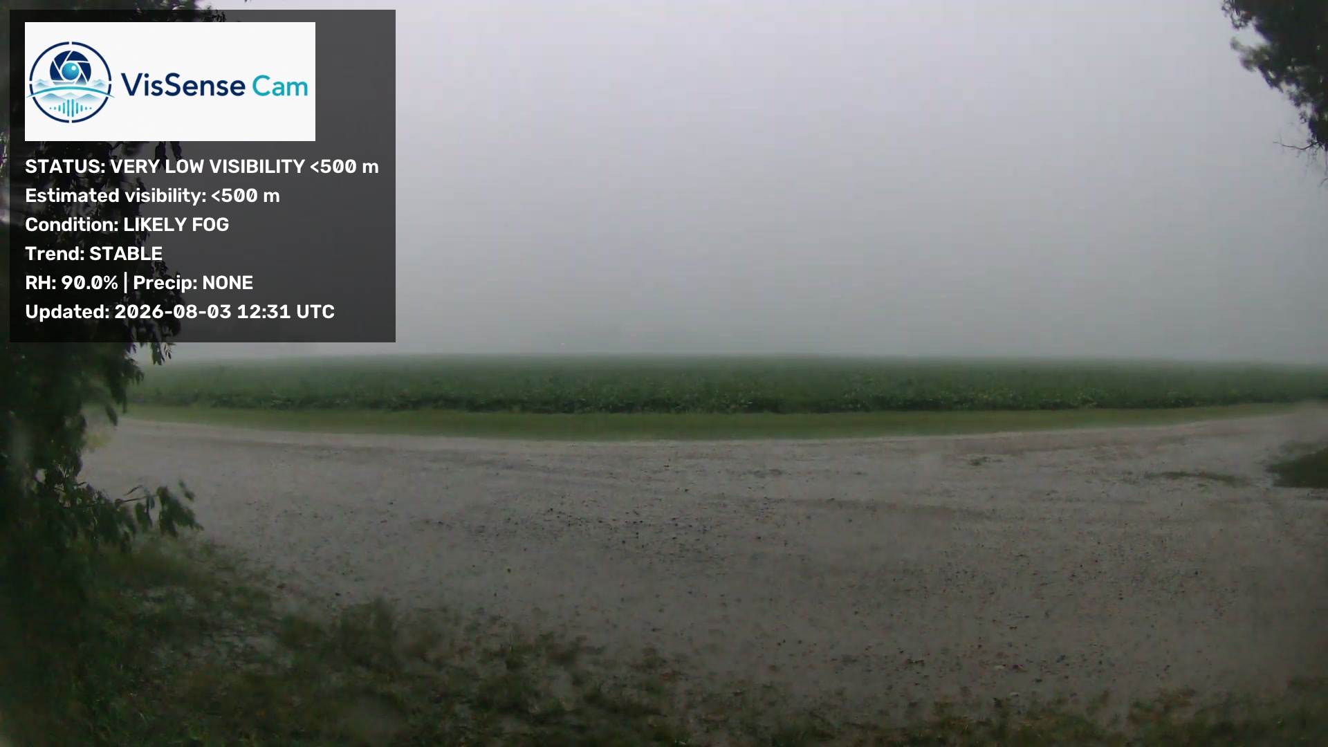
When reduced visibility is supported, precipitation is absent, humidity supports fog formation, and the camera shows compatible optical degradation, the condition can be reported as likely fog.
VisSense Cam is currently a research prototype. The framework has demonstrated useful low-visibility detection within the available development and validation data, but a new camera or site should not be assumed to have equivalent performance solely because a calibration was created.
Each new deployment should be checked using independent visibility observations and representative clear, fog, and precipitation cases.
Localized weather observations are preferred. When METAR fallback is required, the selected station and its distance from the camera should be retained in diagnostics.
The framework is intended to support situational awareness and research rather than replace certified operational visibility or aviation-weather instrumentation.
VisSense Cam builds on camera-derived optical analysis, meteorological observations, machine-learning visibility modeling, and deployment-oriented weather research in the Department of Atmospheric Sciences at the University of North Dakota.
The current prototype is intended to support research on localized visibility awareness for aviation, UAS/AAM, roadway, and remote-site applications.